App updates: latest from ForeFlight, Garmin, WingX and AOPA
The ability to get frequent, free app updates remains one of the most powerful features of tablets and smartphones. The app you buy today will probably improve significantly before it’s time to renew, and you won’t have to pay to upgrade. The pace of updates seems to have accelerated in recent months, with all the major app developers releasing new features since Oshkosh. In this article, we’ll recap what’s new in ForeFlight Mobile, Garmin Pilot, WingX Pro7 and AOPA FlyQ.
ForeFlight version 5.4
Just 6 weeks after version 5.3 brought a slew of new features, ForeFlight has released version 5.4 of its flagship app. New features include:
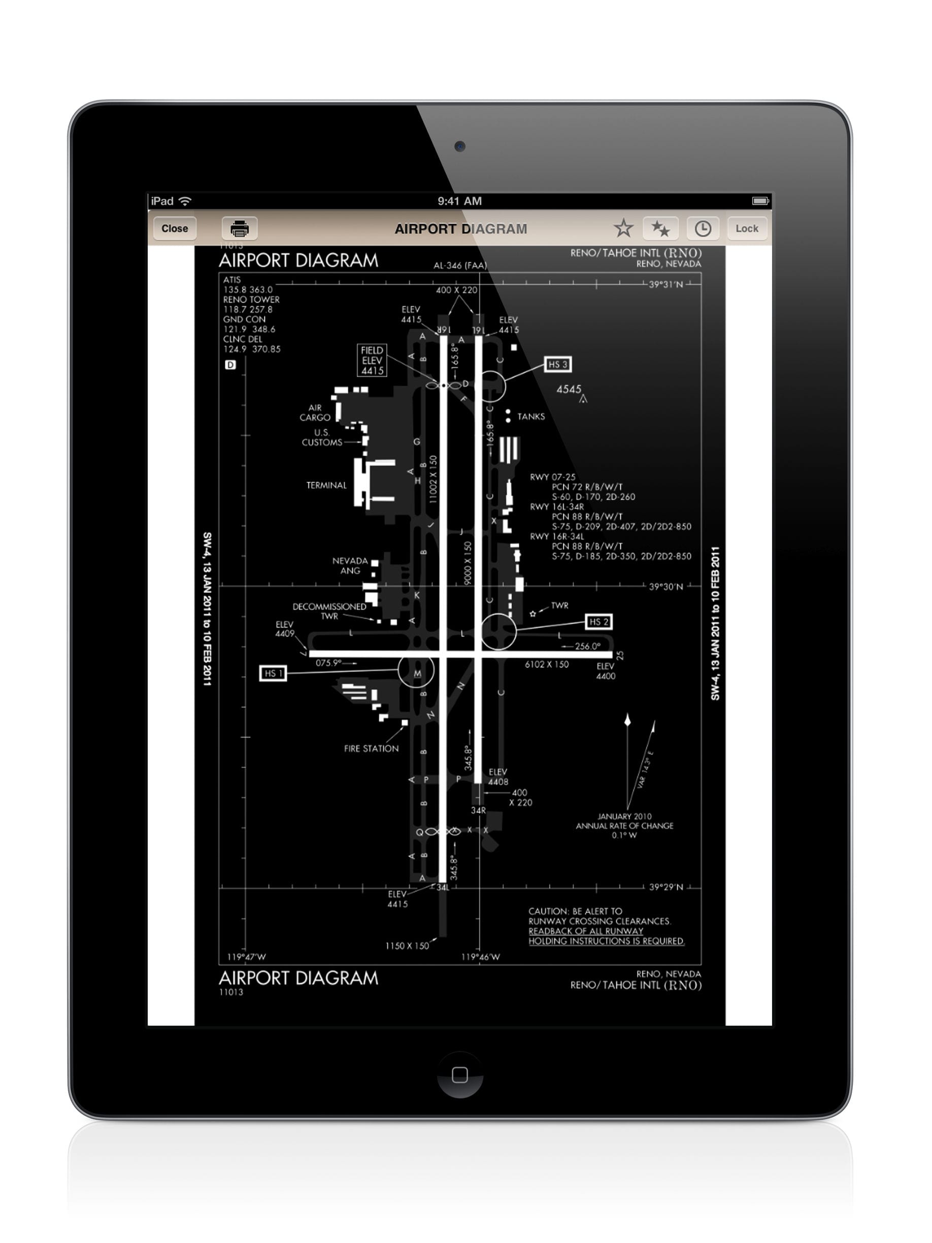
- Plate Annotations. One of the major limitations of digital charts has always been the inability to write on them, and for many pilots used to marking up approach plates this has been frustrating. Now, ForeFlight has arguably made digital charts better than paper–since you can mark them up but instantly erase the markings for a clean chart on your next flight. ForeFlight’s Plate annotations, which requires a Pro level subscription, offers a number of options that go far beyond a simple pencil tool: multiple colors, shapes, text boxes, sticky notes and more. Our favorite use of this feature is for drawing a complicated taxi route at a busy airport. These annotated plates can even be overlaid on the moving map page.
- Search and Rescue. While not needed for many pilots, the new search and rescue (SAR) and Civil Air Patrol (CAP) features will be a welcome addition for pilots flying these missions. While other apps (notably WingX) have offered SAR features for a while, ForeFlight’s implementation seems to offer the most features, including extensive map grid overlays, seven search patterns that can be loaded from the Procedures Advisor and the ability to include CAP, CAP Cell, GARS and MGRS coordinates in routes.
- New touch planning interface. This is a minor tweak, but will be noticeable for any ForeFlight pilot since the touch planning features are some of the app’s biggest strengths. When tapping and holding on the Maps page, the pop-up window now offers three options for each waypoint (by tapping on More): direct-to, add to route and details. The previous setup was a little confusing for some pilots, especially the difference between going direct and making the waypoint the next in the flight plan, so we think this change will be welcomed by most.
As usual, the update includes various other bug fixes and it is compatible with iOS 7. Download the app here.
Garmin Pilot version 5.2
Garmin’s latest release addressed some issues that Apple’s new iOS 7 introduced, but also added some solid new functionality:
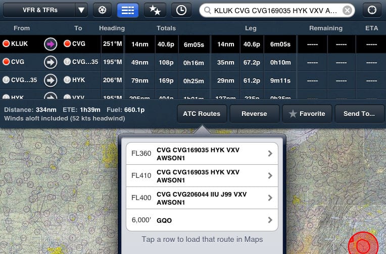
- Proposed routing. This feature is quickly becoming a must-have among the major apps. When using the app to file a flight plan, the proposed route feature notifies you of any changes to the flight plan route. You may have filed direct, but the app can now tell you what you’ll actually fly, and it’s easy to make this route the active flight plan. To enable this, go to the aircraft information page in Settings and select YES in the ATC Proposed Route Notifications.
- Terrain and obstacle enhancements. Garmin has some of the best terrain features in aviation, and they continue to improve them in version 5.2. For a start, terrain maps can now be viewed in split screen mode, and include a route overlay. Pilots can also use the pinch zoom feature on the terrain map and the app has enhanced decluttering logic for obstacles.
- Distance rings. We’ve found this to be a surprisingly useful tool in ForeFlight, especially when dealing with weather, and it’s now available in Garmin Pilot. Concentric rings around your aircraft show how far you are from airports, airspace, terrain and weather. Select one or two rings, and either automatic or fixed ranges.
- Runway extended centerlines. Another small but important detail for many pilots, this feature was practically invented by Garmin with its portable GPSs in the late 1990s. In the app, centerlines can be displayed as the approach plate-style feather or the classic Garmin dashed line. This feature is selected from the ownship/route tab in the Map Layer settings.
- New iPhone menu. Garmin Pilot works quite well on iPhone as well as iPad, and version 5.2 adds a new menu layout for the iPhone. It adds a few new buttons, which overall makes it faster and easier to navigate around the app.
Download the update in the App Store.
WingX Pro version 7.1
It’s been a busy year for WingX, and the version 7.1 update mainly focuses on adding additional third-party hardware support:
- NavWorx ADS600-B support. WingX is one of the first apps to add compatibility with certified avionics in the airplane, and the app can now receive GPS and ADS-B traffic/weather data from the remote mounted NavWorx ADS-B Transceiver (UAT).
- Guardian Avionics Aero-454 support. The Guardian Aero-454 is a TSO-certified device that interfaces with panel-mount Garmin and Bendix/King GPS receivers, and wirelessly broadcasts the GPS position data in the cockpit. WingX can receive this GPS data and will automatically update the flight plan in the app when you make changes to your route on the Garmin or Bendix/King navigator.
- Direct interface with portable Dual GPS receivers. This allows pilots to bypass the iOS 6 location services bug that has affected certain users.
- New TFR engine. Staying up with TFRs is a top priority for pilots, and WingX updated their TFR engine to ensure that TFR data displayed in the app is reliable and current. It also displays additional details on TFRs, including facility and contact information.
- Other updates. Version 7.1 includes a list of other small updates, including a Show VOR option on the moving map, a new route sequencer, improved Baron Services graphics quality, nearest intersection display and an improved download manager.
Download the WingX update in the App Store.
AOPA FlyQ 1.2

The FlyQ preflight checklist helps you verify all the necessary charts are downloaded for your flight.
The AOPA FlyQ app is the newest of the apps mentioned here, and this update represents the most significant one to date. Version 1.2 brings several new features and enhancements, along with significant improvements to the performance of the app:
- New map overlays. You can now enable a Hazards layer on the moving map, which displays color-coded yellow/red terrain warnings and obstacles on both the 2D and 3D map views in flight. During preflight you can view airport fuel prices and AIRMET/SIGMET overlays to help with route planning. And the weather radar overlay received a much-needed update, making it easier to view on the map and interpret the precipitation gradients.
- Enhanced airspace information. Double tap anywhere on the moving map to get detailed information about nearby airspace. This will display a pop-up window with a visual depiction of the airspace layers, and is very helpful for quickly determining the boundaries of Class B, C and D airspace. You can also use this to get more info on special use airspace, like MOAs, Restricted and Prohibited areas.
- Preflight checklist. This is one feature we’ve not seen on any app before, and it’s pretty nice. This checklist does a quick analysis of your iPad’s current setup, and displays red or green status symbols to indicate if the proper charts and data are downloaded for your active flight plan. This is a great way to quickly check that you have all the VFR/IFR charts downloaded prior to startup.
- Airports page improvements. The airports section of the app contains several small improvements. You can now display a wind arrow overlay on airport diagrams, useful for visually determining the best runway to use. The runways section adds the crosswind component for each runway based on the reported winds. And when in the airplane, the app includes a new option to automatically display the airport diagram after landing.
- Additional ADS-B support. FlyQ 1.2 adds support for the Clarity line of ADS-B receivers. Pilots flying with the Clarity SV will also get accurate pitch and bank information displayed in the 3D synthetic vision view.
The latest version of AOPA FlyQ is available in the App Store.
- Do I really need to use Airplane Mode on my iPad or iPhone Pilot? - December 31, 2025
- Flying with the Garmin D2 Mach 2 and D2 Air X15 - October 28, 2025
- Weather planning with Garmin Pilot: widgets and flight profile - October 22, 2025


Do u have to have data with, say AT&T or Verizon,if you get a GPS receiver like stratus?
No you do not.