ForeFlight update adds Stratus support
ForeFlight recently released version 4.5, a substantial update for the app that enables ADS-B weather and adds other features. The update is free, and available in the iTunes App Store.
Subscription-free weather
The big news here is that pilots can now view in-flight weather on ForeFlight Mobile without a monthly subscription by using Stratus, a wire-free ADS-B receiver available from Sporty’s. Stratus seamlessly integrates with the app, showing NEXRAD radar, METARs, TAFs, TFRs, Pilot Reports and more. Because it uses the FAA’s network of ground stations, all weather data is transmitted free.
Stratus is completely wire-free, with built-in GPS and ADS-B antennas and an internal 8-hour battery. This makes it the least expensive and most portable solution for in-flight weather on the iPad. As ForeFlight says, “Stratus is a great step forward for low cost in-flight weather.”
Easier direct-to navigation
In addition to ADS-B weather support, version 4.5 also adds some other exciting features. For example, direct-to navigation is now easier than ever. Pilots can simply enter D in front of an identifier for instant navigation from present position to the identifier. For example, simply enter D I69 in the search box at the top right of the map page to go direct to the Clermont County Airport.
Estimated departure time updates
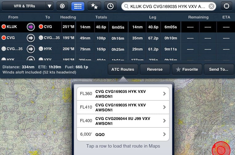
Another handy update allows pilots to update a departure time and view the appropriate weather forecast and winds aloft. For example, entering I69 KIAD +2h would update the flight plan from Clermont County Airport to Washington Dulles for two hours from now. Likewise, I69 KIAD 11:30am would update the flight plan to 11:30am local time.
Flight plan altitudes
The File & Brief tab is a great way to plan flights, but for pilots who fly at low altitudes, ForeFlight has been a little restrictive about cruise altitude rules. Not any more. Below 4100MSL, ForeFlight will now let you fly at any altitude.
Name favorite routes
Finally, ForeFlight now allows pilots to name favorite routes. Simply create a route using the search box on the Map tab, then tap the star button. This will make the planned route a favorite, and it will prompt you to name the route. This can be a real time saver for pilots who fly the same route frequently.
- Do I really need to use Airplane Mode on my iPad or iPhone Pilot? - December 31, 2025
- Flying with the Garmin D2 Mach 2 and D2 Air X15 - October 28, 2025
- Weather planning with Garmin Pilot: widgets and flight profile - October 22, 2025


I don’t understand why everyone is so ga-ga over fore flight.
It is a nice pre-flight planning tool, but until fore flight decides to add track up displays, I don’t think it should be used for in-flight navigation unless you have a dedicated navigator.
Pilots are taught from day one to orient charts and maps track-up. Now I know not all pilots listen and follow what they were taught, but track-up orientation is the defacto way of flying.
Get yourself in a stressful or emergency situation with a map that has a north-up orientation – unless you happen to be going north – you are setting yourself up for a gross navigational error or worse.
I have asked fore flight to implement track-up display for the better part of 2 years and the reply is a consistent “we don’t want to have to read the map sideways or upside down.”
I thought it a rather peculiar answer from an “aviation” software company.
North-up display is pretty, but does not account for how the body and mind respond to the stress induced by an emergency or precarious situation.
I have no financial interest in any software or hardware, I just hate to see people set up for failure because they are not properly informed of the facts.
John, track up is certainly a nice feature for some people. But I have to say that I do 100% of my flying north up and always have. That’s the way the sectional reads, that’s the way I set up my panel avionics and I know lots of others who do. To say that no track up is a major safety problem just isn’t true. Different minds think different way.
Hi John:
I can see how you feel that way, but your feeling ignores the difference between the sympathetic and para-sympathetic nervous systems. Therein lies the rub about different minds working differently – at normal levels of stress, yes I agree; but what works under normal conditions does not always work under stress.
Under stress your mind (not yours personally, the human mind) looses it’s ability to think rationally – along with a laundry list of other things that take place including an adrenaline dump and the loss of fine motor skills.
Under normal conditions you may have no difficulty doing the mirror image thing to transpose what your read on the chart to what you see out the window, however, under stress that ability will go out the window.
If flying with a north-up orientation worked as well as you believe it does, the military would train that way. The only military aviators I knew of that used north up chart orientation were navigators that had a desk to work on and no window to look out of.
In 26 years of military flying and 25 years at a major airline, I never flew with a pilot who oriented a map north-up unless that is the direction we were flying.
Flying track-up provides the training you will need when you encounter a critical problem and are unable to do the mirror image transposition simply because that is how we area all wired.
There are many areas in flying where you can say potato and I can say pohtatoh, this however is not one of them.
I find it pretty easy just to rotate the iPad if I’m in the mood for track up.
I find this conversation to be interesting, and informative. It would be more so if someone could discuss what ForeFlight’s competition is doing. Wouldn’t turning the iPad around to orient it in the direction of flight put the buttons in the “wrong” place for ease of operation? I’m only asking as I’m about ready to buy an iPad and software; but haven’t made up my mind as yet.
Neither Foreflight nor Garmin Pilot support track up. Anywhere Map supports track up, but their iPad offering is not yet ready for the cockpit. Maybe next year for them…
So far, Air Navigation Pro, is my favorite in-flight app. Air Nav Pro gives you the choice of a track-up or north up display, and along with the chart can give you several variations of flight instruments – I usually fly with the HSI selected. Air Nav Pro also included terrain elevation info.
I tried a couple of AWM products a year or two ago. Loved their software, but the hardware was buggy. I am very hopeful the AWM Freedom will work well on the iPad.
Track up display? You better learn to look at a chart and understand how to read it from a North up perspective. Tipical of a beginner who needs track up to understand where he is going.
Apparently you either did not read, or perhaps you did not understand my posts.
I am far from a beginner and you are free to do as you choose.
Please don’t do this.
Personally pejorative or otherwise generally derogatory comments don’t help.
(To wit, it’s spelled ‘Typical’ 🙂 ).
And I’d be willing to bet that an in-depth analysis by those who do this for a living (airline pilots, military) may well show that Track Up is very well regarded. You don’t have to be dismissive.
Rhetorical question: On your car GPS, do you use Track Up or North Up?
I’m getting back into flying after a 20 yr hiatus (kids, family, expenses kinda got in the way, you know?). ANYhow… I just ordered my iPad3 and got the Dual external GPS, so I can add Foreflight (or better if I find one). This is nearly revolutionary. I don’t think 737 pilots had this much graphic info at their fingertips 15 years ago! (For one thing, GPS wasn’t around back then!). Ok, no one cares about my trip down memory lane…
As for Track UP. YES, that is the only way we were taught – that tower on your left and river on your right on your ‘heads up windshield’ should be that way on your ‘heads down’ display (map). Track up is the way most auto GPS’s are run, I believe. And I can’t disagree that “Hey, if you like North up then have at it :)”.
But what I do NOT understand is why it isn’t a brain-dead decision to simply offer it as an OPTION to the pilot? I doubt the software challenge is that hard…? Then we can say Poe Tae Toe or Pa Ta Ta!
Good Morning Henry:
Welcome back to flying.
The iPad is an awesome tool and can really enhance situational awareness. The hardest part about integrating any electronics into flying is keeping them in their proper place and not allowing them to become a heads down display. Aviate, navigate, communicate, and compute – in that order!
I can tell you that Fore Flight has told me in numerous e-mails over a couple years or better that they are not interested in track-up because “you’d have to read the map upside down or sideways.” I tried to explain to them that pilots have done that for years and it is not a big deal. Bottom line . . . Fore Flight is just NOT interested in track-up.
Wing X does not have track-up yet, but they claim to be working on it.
Any Where Map just released their Freedom app and it is track-up and they did something to the charts so that they are presented “right side up” no matter if you are in a track-up or north-up mode. There are still some bugs in the program, so IMHO, it is not quite ready for prime time, but it does have promise. AWM Freedom has some really cool features and once all the bugs are worked out will be outstanding.
My solution is to use Wing X for flight planning and Air Navigation Pro in-flight. I picked Wing X over Fore Flight simply because I am not interested in paying fore flight if they are not interested in listening to me.
Oh, you just made me realize something.
To do TrackUp, it WOULD take a lot of work to rotate all the labels and wording. Just rotating the map would not be sufficient.
Well, for $75/yr or $6.25/mo (Foreflight), I can’t complain. ALL of this is a QUANTUM LEAP over what I had when I last sat in the left hand seat. And thanks for the tip on Air Navigation Pro – I’ll look into it!
Yes, having the charts appear right side up all the time is a large task.
Why not have the e-chart simply appear as a paper chart would appear? So what if the printing is upside down or sideways. That is what we have done for years, and to say it works better than fine is an understatement.
Once there are sufficient resources to do computer magic to the chart and have it appear right side up regardless of track-up or north-up orientation, the computer magic will be a real bonus – but for now let the e-chart behave as a paper chart.
It isn’t a technical issue as much as it is the mindset that nothing can appear upside down or sideways in the application.
I too find that track up would be welcomed, to say the least. I urge Foreflight to fix this issue, offering it as an option to North up. “Choice” and prudent alternatives should be part of ADM by the pilot when considering potentials.
has anyone used the stratus for ADS-B weather? how does it work? apparantly the nexrad is lower resolution compared to XM weathher – anyone have experience with this? does it seem to matter in practice? considering purchasing but would like to hear from someone whose actually used it…
Adam, I work for Sporty’s so I’m obviously biased. But I can tell you that practically, the resolution doesn’t matter. Regional ADS-B radar (within about 250 nm) is higher resolution and is very close to XM. National ADS-B radar is a little lower resolution. Here are three screenshots side by side that show it well: http://sportys.tumblr.com/post/21855217072/three-views-of-weather-radar-on-foreflight-xm
Hi again.
A neighbor is a pilot for Southwest. I asked him about the NorthUp/TrackUp and his response follows:
“We use track up, never heard of anyone using north up. 1999 was the first moving map display airplane we got – 737-700. Great for situational awareness with overlaid weather and traffic display. I can switch to north up, but have never seen anyone use it”
North up or Track up orientation? This seems to be a pretty minor issue. I am a USAF trained pilot and have flown for 30 plus years and have thousands of hours experience. I have owned several different private aircraft over the decades and currently have a Dakota and fly often. Its just not that big of an issue with North vs. Track up. Either way is fairly easy to adapt to if you are a decent pilot.
Making the statement that all/most professional pilots use track up is just not correct. Its just a personal preference, like what is better, NOAA or Jeppesen charts? It generally goes back to what you learned with.
All maps are drawn with a north up orientation. I have the option in my other GPS and always choose north up, not track up, as the map is always the same orientation, not spinning around on the screen as the aircraft changes direction.
The aircraft symbol depicted on the map tells you your direction of travel over the moving map. It should not be that hard to figure out landmarks, etc. relative to the aircraft’s flight direction.
Is foreflight perfect? No it is not, but its the best out there for an iPad that I have found. The ADS-B receiver is a fantastic option for a reasonable price. Just look at the XM weather subscription price stucture, won’t take long to spend a bunch-o-money. Don’t forget to add in the cost of the unit that receives that information from XM. When you do, its no contest – price wise.
North up orientation on a moving GPS map is very common and yes, an option to change it to track up would be nice for those that like it that way. I would argue that A map that is constantly spinning around on the screen based on your flight direction at that moment seems MORE likely to be confusing (especially if you are new to flying), but that is me.
Safe Flights
I called ForeFlight a few years ago about the track up versus north up problem. I am an FAA designated pilot examiner and I can tell you that north up simply doesn’t work for instrument or vfr pilots under stress or not. And yes foreflights competition does offer track up. I was told specifically by ForeFlight that I was crazy and that everyone could handle north up. Further I was told that trying to do track up on the iPad would make for unreadable maps. Unfortunately for ForeFlight they are wrong on both accounts. Their competition has done track up quite nicely and it’s very readable. as far as the second point goes I think they should let the experts in this industry speak. As mentioned at the top of this post north up is nearly impossible for most people especially under stressful circumstances to recognize their position for situational awareness. I have no problem with people using iPads on check rides but again I can tell you that when people are using north up it confuses them more than it helps them. I let my ForeFlight subscription expire. Someday ForeFlight will listen and someday ForeFlight will realize that it is also technically possible to do track up like their competition does on the iPad. Until then it’s pretty ridiculous that they would argue with us that track up is not necessary. Gee I wonder why jeppesen went through so much trouble to produce chart view where they have their jeppesen approach plates actually geo-referenced on the track up map. I guess it comes down to what you’re willing to pay for. You get what you pay for. If you want to go cheap you get north up. If you want professional products you will get the option of track up including your approach plates being track up. One day ForeFlight will listen
DPE is right on target.
Ben I too am USAF trained. Either USAF changed their training or you were absent from class that day.
Just curious, Ben are you in any way related to Sporty’s, ForeFlight, Stratus, or any of the publications that profit from all of ForeFlights advertising dollars?
Contrary to what Ben asserts, ForeFlight is not the best option for the iPad, merely one of many.
I first came on Boeing glass cockpit in 1989 (737-300)and have been on Boeing glass ever since, (757,767,777) Everything is Track up for the pro’s.
It’s real easy, you sit in the airplane track up, facing forward. Your charts should match your eyes!(Track up).
Ok……..so why won’t foreflight incorporate TRACK UP? Is it so difficult?
Just wondering