8 hidden features in ForeFlight 8
ForeFlight made a big splash this summer with the release of version 8, which delivered a new data-driven aeronautical map layer. While the new map generated most of the hype during the announcement, there were many other enhancements you may have missed. Here are 8 hidden features in the latest version of ForeFlight to check out on your next flight.
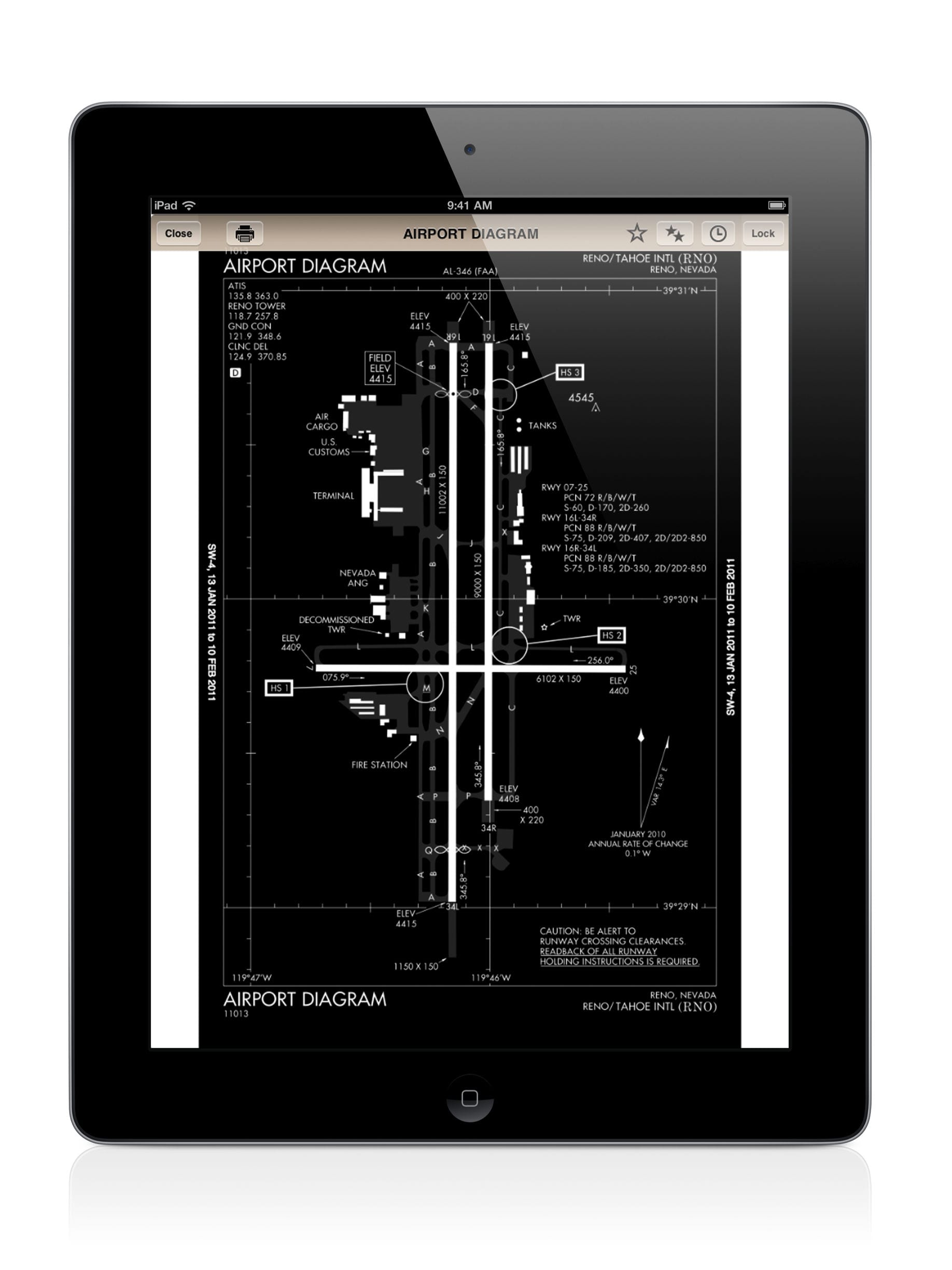
Embedded airport diagrams The Aero layer also includes airport diagrams right on the Maps page – no need to visit the Plates or Airports pages. Just keep zooming in on an airport and you’ll see a geo-referenced airport diagram, complete with taxiway labels and FBO locations.
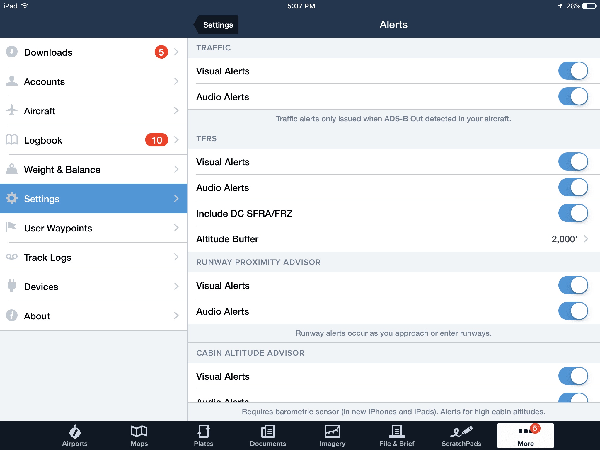
New dedicated alert settings page (with new TFR alerts) ForeFlight continues to add new in-flight alerting features with each release. In an effort to declutter the main settings menu, ForeFlight created a new dedicated Alerts screen accessed from the settings menu. Here you can customize your alert preferences, and enable the new TFR visual and audio alerts, which were also added in ForeFlight 8.
Two-thirds view on iPhone With today’s iPhone screens approaching the size of the iPad Mini, ForeFlight added a new two-thirds view to the map screen to make better use of the large display. Tap anywhere on the Maps screen and you’ll see the info box slide up from the bottom just below a smaller view of the map. This allows you to explore all the details for an airport while still viewing a sectional or other chart layer.
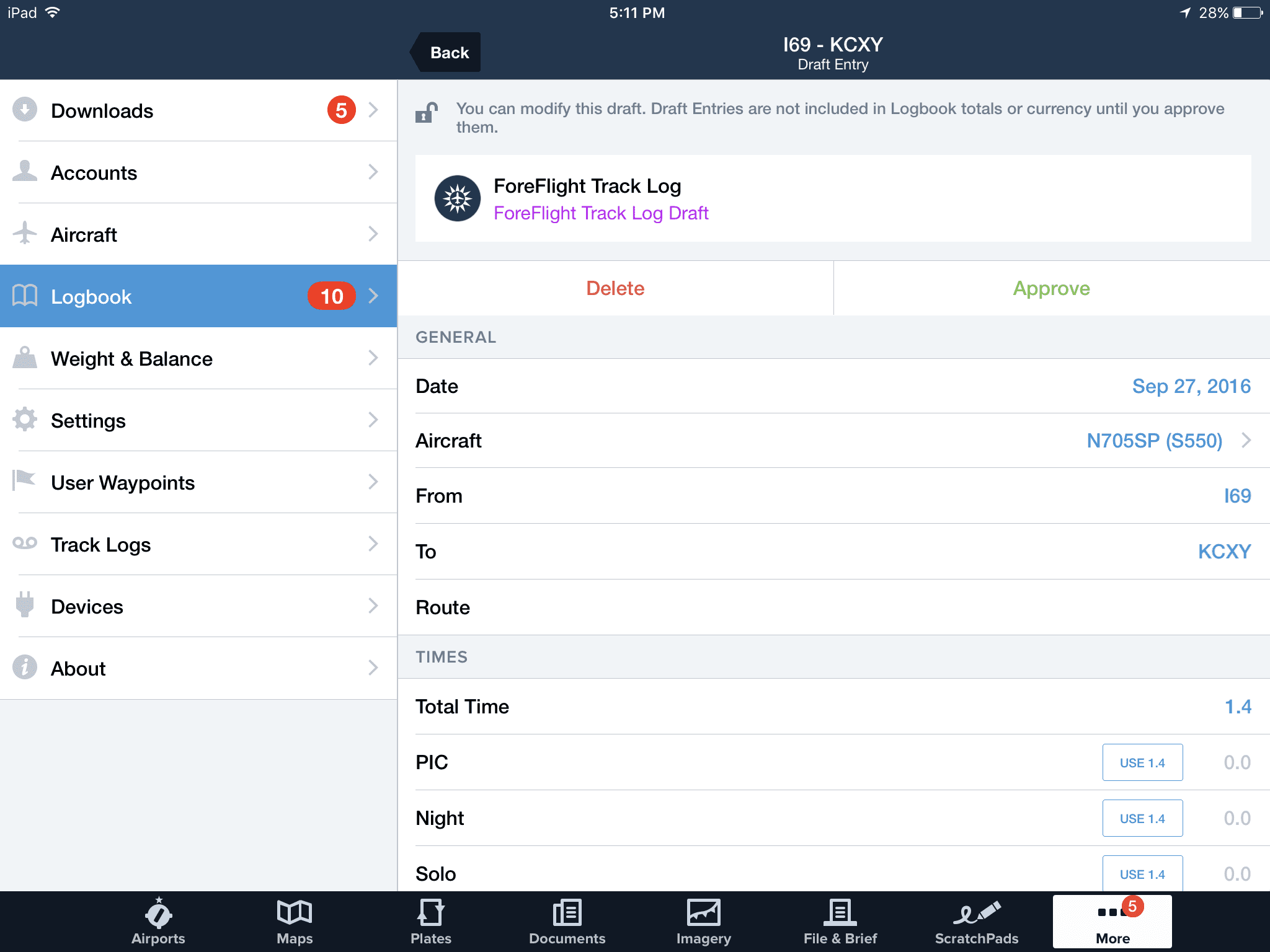
Automatic N# capture in logbook When flying in an airplane that is ADS-B out equipped and using the Stratus ADS-B receiver with ForeFlight, the Logbook function will automatically capture your N# in the auto-generated logbook draft entry.
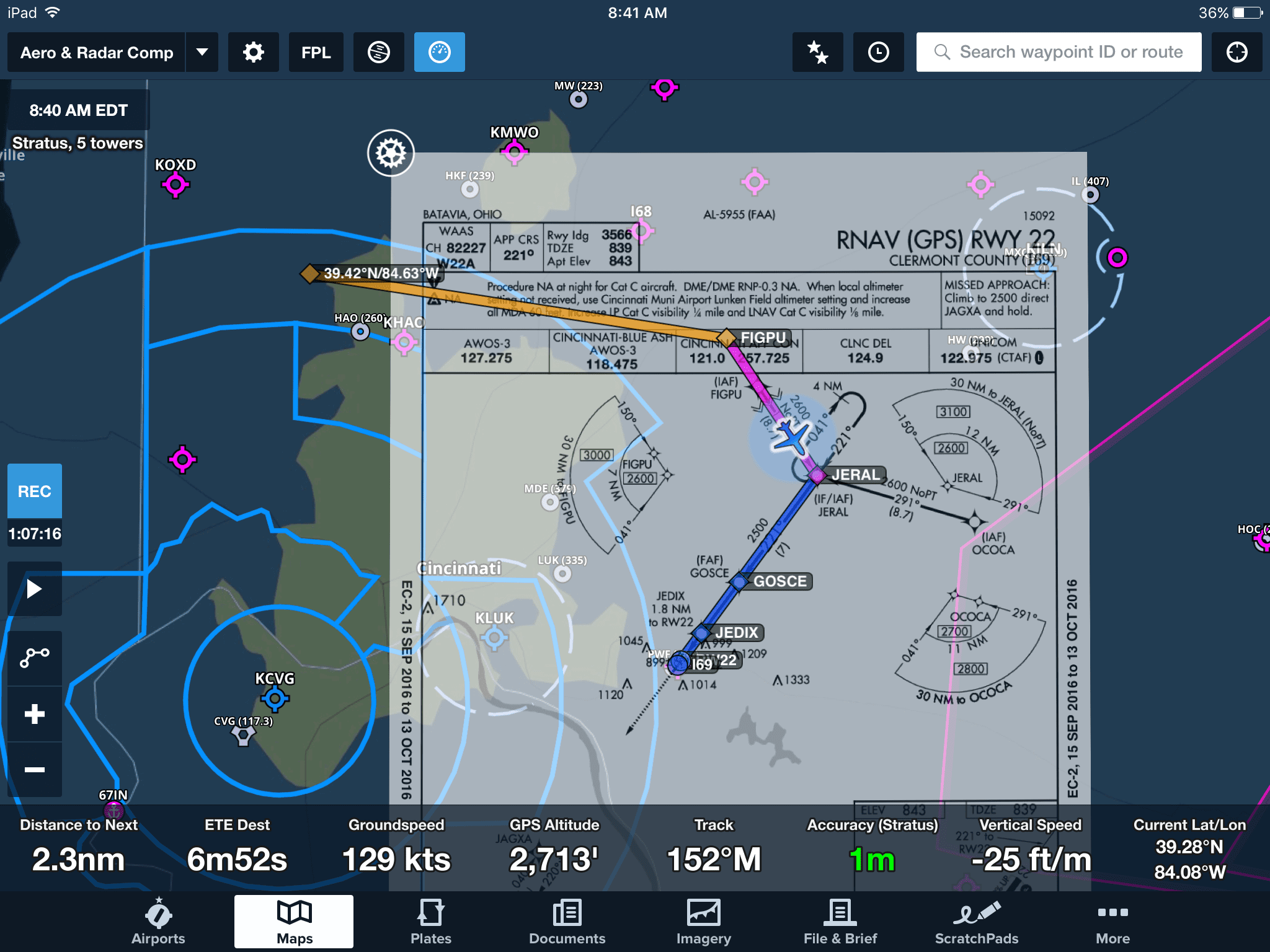
See-through approach charts with dark aeronautical map theme The new dark aeronautical map theme makes it much easier to view approach plates on the map with the opacity turned down. This allows you to still read all the approach chart details, while keeping an eye on airspace and other features underneath – a much cleaner look when compared to doing the same thing with a sectional or IFR en route chart.
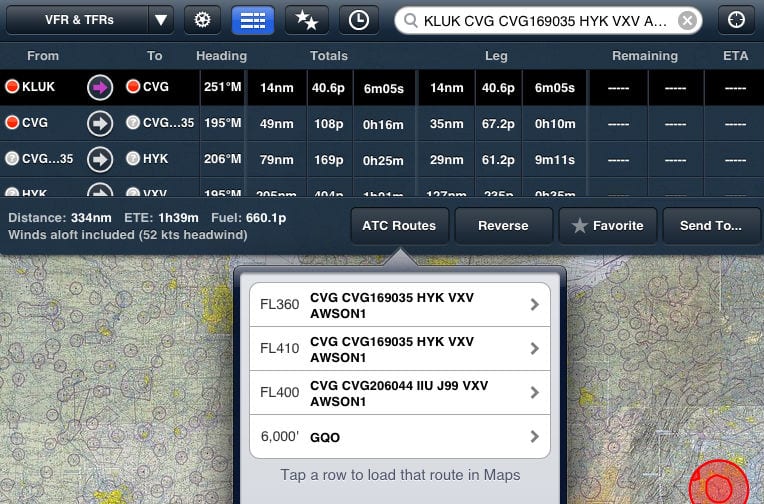
MEA and MOCA altitudes appear on the route lines when victor airways are entered in flight plan At first you may think the airway overlay looks a bit bare on the new aeronautical map layer compared to the same view on the FAA IFR en route charts. They come to life though when you enter a victor airway in your route, displaying the minimum IFR altitudes for each segment.
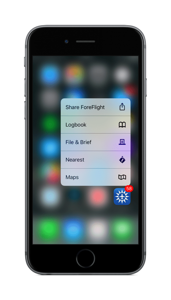
3D touch on iPhone Pilots flying with an iPhone 6S or newer can take advantage of ForeFlight’s 3D touch feature on the home screen icon. Press down firmly on the icon and you’ll see shortcuts to go right to the Logbook, File& Brief, Nearest and Maps sections of the app.
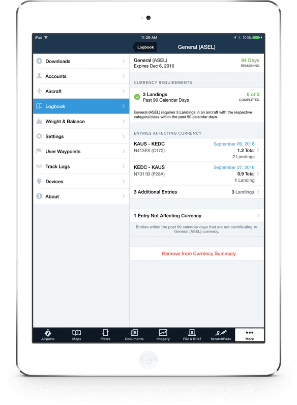
Logbook currency monitoring One of the great benefits of using a digital logbook is to be able to quickly determine your flight currency at a glance. In addition to showing color-coded currency status, ForeFlight 8.1 now shows the individual entries used to validate each item, allowing you to better understand your currency and potentially spot entry mistakes.
- iOS Update Green Light program: iOS and iPadOS 26.2.1 - January 26, 2026
- Garmin inReach Mini 3 Plus adds full color screen - January 23, 2026
- Top Apple Watch features and apps for pilots - January 19, 2026











Nice summary of features. It’s not clear, however, if additional subscriptions are necessary more me to take advantage of them. FWIW, I’ve noticed this particular omission in prior articles about ‘new’ ForeFlight features. Also, you might wish to check the article for grammatical errors. For example: “They come to life though when enter a victor airway …” It’s a small thing, but so too is missing the DH or the initial step in a Missed Approach.
Thanks for creating and then sharing these helpful tips.
You may want to check your own grammar before getting onto someone else. “It’s not clear, however, if additional subscriptions are necessary MORE me to take advantage of them.” Just saying.
Get a life Grammar Police. 🙂
Wow angry people. Now back to subject. It would be nice to know what subscription is necessary for these features.
The Aeronautical map features (embedded airport diagrams and MEA/MOCA depiction on airways) and Logbook require the ForeFlight Basic Plus subscription. The geo-referenced approach charts, along with the ability to overlay them on the moving map, require a ForeFlight Pro subscription. More info here: https://foreflight.com/pricing
Notice lately all of the newest ForeFlight features require a PLUS subscriptions? Logbook, aeronautical maps, etc. My current fees are paying for new feature development, then have to pay again to use them. Bad business model in my opinion but we will see how the user base responds.
Disappointed with the new $200 price for pro version, since I had the pro without synthetic vision & some of the other stuff I don’t need for $150.
I also thought I saw somewhere that the text can be rotated to an upright position no matter what the rotation is. This would be a real benefit, since I fly with track up. Can someone confirm?