ForeFlight version 5.0 adds terrain, runway centerlines
After recently adding track up and obstacles, ForeFlight seems focused on making their best-selling app an even more powerful in-flight tool, in addition to its numerous pre-flight uses. Version 5.0, just released to the App Store this weekend, ups the ante yet again, with a slew of new features that show just how powerful an iPad can be when connected to a GPS source.
Terrain is the big new feature here, although there are plenty of other interesting additions:
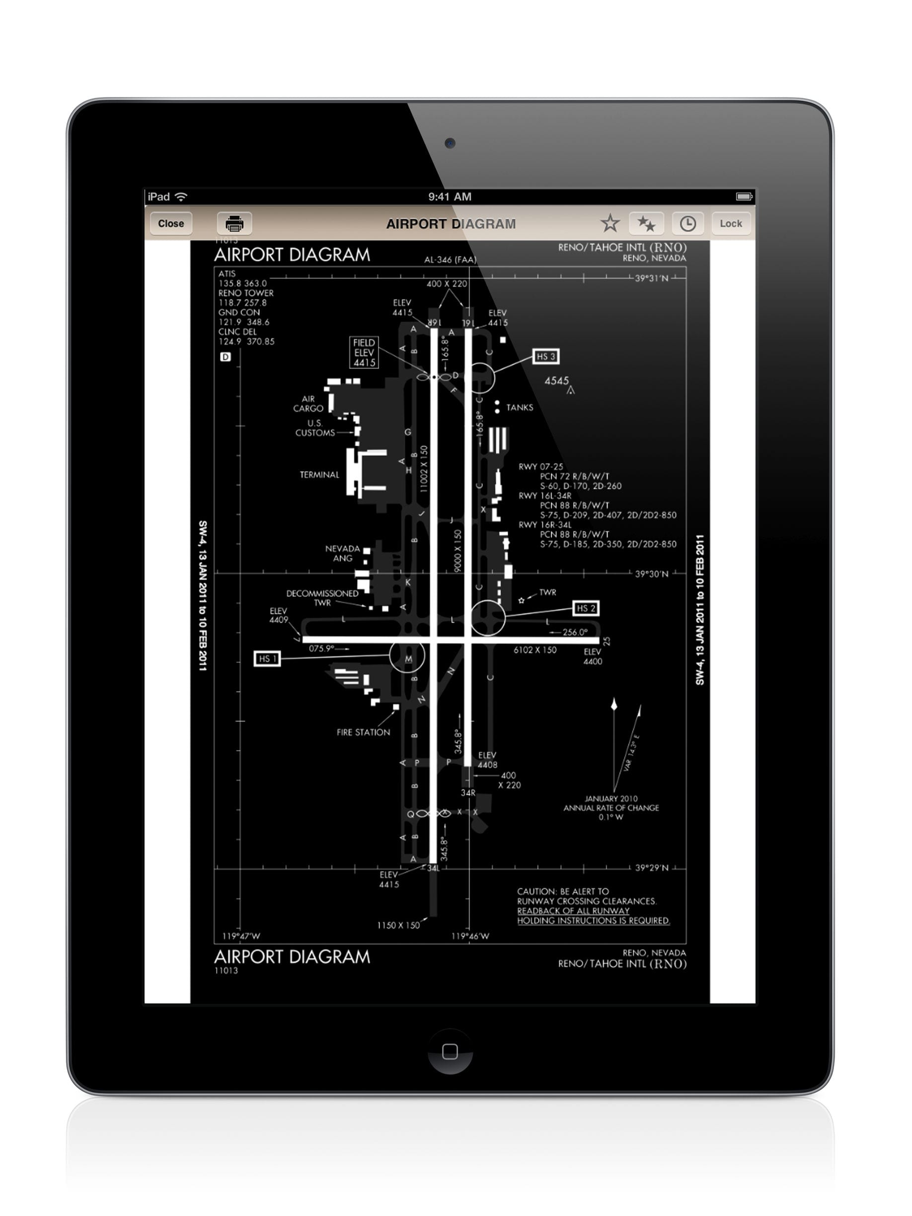
- Taxi diagrams automatically display. After landing at an airport with a FAA-published taxiway diagram, ForeFlight will automatically switch to the taxiway diagram as you slow down. This is especially helpful at busy airports, where looking down to tap on an airport diagram on your iPad would keep your eyes inside the cockpit at a critical time. Now it just appears, and for Pro subscribers, your airplane’s position will show in the chart. This feature is enabled in the Settings menu.
- Extended Runway Centerlines. This feature has been a favorite of pilots since the days of black and white aviation GPSs, since it improves situational awareness and makes it easy to line up on final. These centerlines can be turned on from the gear menu on the Maps page, and show up for the airports on your route.
- Traffic Pattern Advisor. This feature, an enhancement to the Runway Advisor, is one we haven’t seen anywhere else. From the route editor box on the Maps page, you can tap the Procedure button, then select your destination airport and a runway. From there, ForeFlight will offer multiple traffic pattern entries and draw them on the map. It’s a great way to fly a precise pattern, or just to visualize different entries. This feature does not work on the iPhone version of the app.
- Runway wind components. Throw out the whiz wheel and forget your high school trigonometry–this feature automatically shows headwind and crosswind components for each runway based on the latest METAR. It’s great for performance calculations or making the go/no go decision on a windy Spring day. Go to the Airports page, then tap Runways.
- Plate rotation button. This may seem obscure, but for regular instrument pilots, it’s a welcome change. Some charts, especially instrument arrival procedures, are printed in landscape format. Since the screen will re-adjust if you rotate the iPad, it can be hard to read these charts the right way. Problem solved with the new Plate Rotation button. Tapping this small arrow will rotate the current plate 90 degrees at a time, so every chart can be displayed at full size.

Version 5.0 of ForeFlight features an incredibly detailed terrain map with altitude-sensitive alerts.
Two other features in version 5.0 are even more impressive, but it’s worth noting something about them. For the first time, some features in ForeFlight are not available for the iPad 1. While the company has done an admirable job of supporting older hardware, the iPad 1 simply can’t keep up with some of the higher end features now hitting the market. If you’re still flying with one, it may be time to consider an upgrade.
With that limitation in mind, though, we think pilots will be extremely impressed with these enhancements:
- Global Terrain Map. This feature adds another option for a basemap on the Maps tab, and is downloaded so it’s available in flight. It offers a relief map that is amazingly detailed, and is especially impressive in mountainous terrain. ForeFlight says this terrain map is far more detailed and accurate than most other ones available, and fills in a number of voids. The result is a more accurate database, and better-looking too; we think “HD terrain” is the right description.
- Hazard Advisor. Taking terrain to the next level, the all-new Hazard Advisor adds another map layer that highlights terrain and obstacles within 1,000 ft of your altitude. Anything within 1,000 ft is yellow, and anything within 100 ft (or above your airplane’s altitude) is red. With the terrain basemap and the Hazard Advisor and Obstacle layers turned on, pilots will get a detailed look at any natural or man-made obstacles in their flight path. This feature does require a GPS source (it’s only active above 30 knots) and it also requires a Pro subscription.
As always, the update is free, and available now in the App Store.
- How to Improve Your iPad’s Battery Life - February 19, 2026
- Do I really need to use Airplane Mode on my iPad or iPhone Pilot? - December 31, 2025
- Flying with the Garmin D2 Mach 2 and D2 Air X15 - October 28, 2025


It would be helpful at the start or the end, when you show a new add on, as you do of the 7 above, it its available in all subscriptions or just PRO. Thanks. You do on the Hazard adv. can I assume that all the other ones are for standard except the plane location on landing in the first one.
Yes, unless we point it out you do not need Pro.
The Jepp Mobile FliteDeck is no longer available on the Apple store for the Ipad. Is the Foreflight application a good replacement? Thanks
Yes, I understand that it’s meant to sell the pro package with its added advantages by not tell us that until at the very end! But it sure is a pain if your the “strictly VFR pilot” customer.
I like the idea of the “wind component”, but for the life of me, I can’t figure out the green and gray arrows. It seems like they point in the opposite direction. Can someone please describe what each of the 3 arrows mean. I know one is Xwind….?
Thanks
ForeFlight version 5.0 adds terrain, runway centerlines – iPad Pilot News