New updates available for ForeFlight, Garmin, WingX Pro and FltPlan Go
We’re only a few weeks into 2016 and most of the major aviation EFB companies have already released updates adding new features to their apps. Most of these are relatively minor refinements, but they’re important to keep track of to help you continue to get the most out of each app.
FltPlan Go
FltPlan Go continues to increase the capability of the moving map screen in the app, and the latest update adds the popular split-screen utility to this page. This allows you to view a geo-referenced moving-map on one side, and a variety of other data on the other, like approach charts, scratchpad or weather reports, on the other side.
You’ll find a new button at the top left of the Maps screen with a horizontal arrow symbol, which activates the split-screen display. You can then choose to display airport information, instrument procedures, navlogs (saved from FltPlan.com), weather reports, scratchpad or calculator tools.
 Garmin Pilot
Garmin’s latest release takes advantage of the new services provided from Lockheed Martin Flight Service. When filing VFR or IFR flight plan within Garmin Pilot, on iOS and Android devices, the app will submit the data directly to Lockheed Martin to ensure delivery in the standard International Civil Aviation Organization (ICAO) format.
Once you have created your route, select File and Brief in the Summary tab to auto populate the information into the Trip Planning section of the app. Lockheed Martin is the default filing service, and here you can choose between FAA/Domestic and ICAO form types. Once submitted, you will receive an email confirming that your flight plan has been filed, and it will then be immediately available to ATC.
ForeFlight
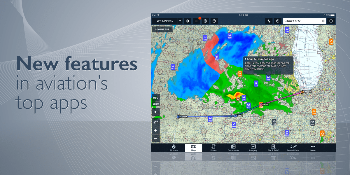
The Pilot Weather Report (PIREP) layer on the ForeFlight Maps view received a facelift, and the newly styled markers can now convey important information even before you tap on them. Icons representing icing, turbulence, and general sky and weather reports change their appearances based on the severity of the hazard, and also indicate the altitude at which the report was made, if available. Also, Urgent PIREPs are labeled with a red badge to help you quickly identify when severe conditions are reported.
The icons you see when viewing AIR/SIGMET summaries have also been updated to match the new PIREP markers. Check out this article from ForeFlight weather scientist Scott Dennstaedt for an in-depth look at the PIREP enhancements.
ForeFlight also announced that they acquired the free web-based fuel card management service JetFuelX. This service makes it easy for owners and operators of turbine aircraft to save money by quickly finding the lowest prices available from their multiple jet fuel discount program memberships. While there is no direct access to the JetFuelX service in the ForeFlight app, we’d expect to see some integration down the line.
WingX Pro
The latest WingX Pro update primarily focuses on refining its integration with a variety of portable ADS-B receivers. There are also now options to turn off the display of the ADS-B traffic N# data tag, and to show ADS-B traffic when not receiving a GPS location.
This update adds some new chart options: IFR Area Charts, Helicopter Charts, the Grand Canyon Chart and Gulf Coast Charts. All of these are available as optional overlays on the moving map, and allow you to Save/Load user-created traca™ routes. Users can also turn the TAC layer on and off, adding some flexibility.


As a long time ATP, it is a mystery to me why Pireps still need to be in the very old teletype format.