
Garmin Pilot improves NOTAM display and adds Stratus 3 support
|
Getting your Trinity Audio player ready...
|
Garmin recently released their biggest update for 2021 and it’s chock full of practical features you’ll want to check out the next time you open the app. At the heart of this update is a revamped Airports page, which has been redesigned to provide at-a-glance access to the most widely used information. Garmin also added graphical Field Condition (FICON) NOTAMs to help you better identify when a runway is slick from rain or snow, as well as Fuel Unavailable NOTAMs. Lastly, this update adds support for the popular Stratus 3 ADS-B receiver from Appareo.
Airports Page Updates
The first big change you’ll notice is an improved Airports page. Garmin updated the page header to include the types of instrument procedures available for the airport, weather conditions and communication frequencies. You’ll also see a horizontal navigation bar providing quick access to runway information, charts, FBOs, weather and NOTAMs:

The FBO page was also redesigned to display essential information front and center. Icons were added to the menu of FBO services for quicker recognition and comparison:


New graphical FICON and Fuel NOTAMs
Airport suitability is at the top of most pilots’ lists during flight planning, which at a bare minimum requires a check of airport status, runway condition and fuel pricing/availability. Garmin already displays airport and runway closures both on the interactive map and airports page with bold red highlights, making this check difficult to overlook.
To assist with the runway condition checks, Garmin added new graphical FICON NOTAMs, which are issued by airport operators when braking action is reduced due to liquid or frozen precipitation present on the runway surface. You’ll see a yellow badge on the map at the end of each runway with a numeric value, from 0 to 6, representing the braking action for each third of the runway: touchdown, midpoint and rollout:

A value of 0 represents nearly non-existent braking action due to contamination, while 6 represents a dry runway (learn more about the FICON codes here). If you’re like us and don’t have all the intermediate values memorized, you can tap the yellow badge to display a NOTAM pop-up window, and then the “i” button at the end of the report to view the decoded description of the FICON value(s):

Another no-go variable to investigate while flight planning is fuel availability, which has been a real issue across the U.S. this year. To help bring additional visibility to airports out of fuel, Garmin will display a red warning triangle and a strikethrough across the reported price, when viewing fuel prices on the map:

You’ll also see a red warning banner on the top of the Airports page:

Stratus 3 Support
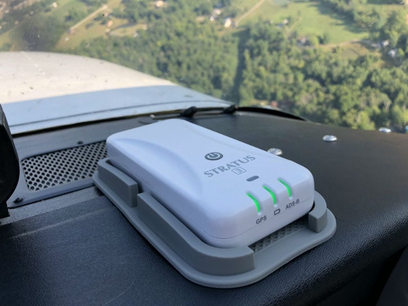 Garmin has been slowly opening up its hardware and software support for products other than those developed out of its headquarters in Olathe, KS, over the past few years. In a move that we didn’t see coming, Garmin Pilot added support for Appareo’s Stratus 3 ADS-B receiver (read our PIREP on Stratus 3 here), in addition to its own line of GDL portable ADS-B receivers.
Stratus 3 is a high-performance device and our top choice for those who want the flexibility to use an ADS-B receiver with multiple aviation apps. It enables the same familiar navigation and ADS-B features in Garmin Pilot as Garmin’s own GDL hardware, including GPS, AHRS (displayed on the attitude indicator and synthetic vision), datalink weather and real-time traffic. After connecting Stratus 3 to your device’s Wi-Fi network, open Garmin Pilot and you’ll see connection status in the Devices section of the app. It then works as seamlessly as other receivers compatible with Garmin Pilot.

What else is new
There are two other new features to check out after updating. First, the distance measuring tool (a.k.a. digital ruler) has been enhanced to include time and fuel burn estimates. The aircraft selected in the active flight plan determines which performance tables are used, and the winds/temps aloft forecast is included in the calculations.

When preflight planning, the altitude and ETD are taken from the active flight plan. When navigating, the current time and altitude are used for the calculations.
Lastly, Garmin Pilot 10.6 includes a new filter for along-path NOTAMs that are displayed in the split-screen widget. When enabled, the filter will display only NOTAMS that are visible along the active flight plan on the map, like a NAVAID outage for example. This feature is activated by pressing the blue filter button (looks like a funnel) to the right of the NOTAMs header on the widget.

- ADS-B Quiz for Pilots: Test Your Datalink Weather Knowledge - June 16, 2026
- The 10 Best Weather Apps for Pilots—2026 Edition - June 10, 2026
- What to Do When Your iPad Gets Too Hot (or Too Cold) in the Cockpit - June 5, 2026

