
Using Garmin Pilot’s freehand feature to deviate around weather
|
Getting your Trinity Audio player ready...
|
Sometimes the real magic of technology is when multiple features come together to make 2 + 2 = 5. So it is with electronic flight bag apps and datalink weather—both are useful, but when used together pilots can make smarter decisions and easily avoid bad weather. This was demonstrated on a recent trip with Garmin Pilot, where the app’s Freehand feature came in handy.
Freehand is a way to graphically edit the active flight plan, whether you’re avoiding airspace or finding cheap fuel. Instead of entering waypoints, you simply draw your preferred route. In this case, SiriusXM datalink weather showed several areas of thunderstorms along our route and we were working with Air Traffic Control (ATC) to find a safe deviation plan. That’s where this quick tip came in.
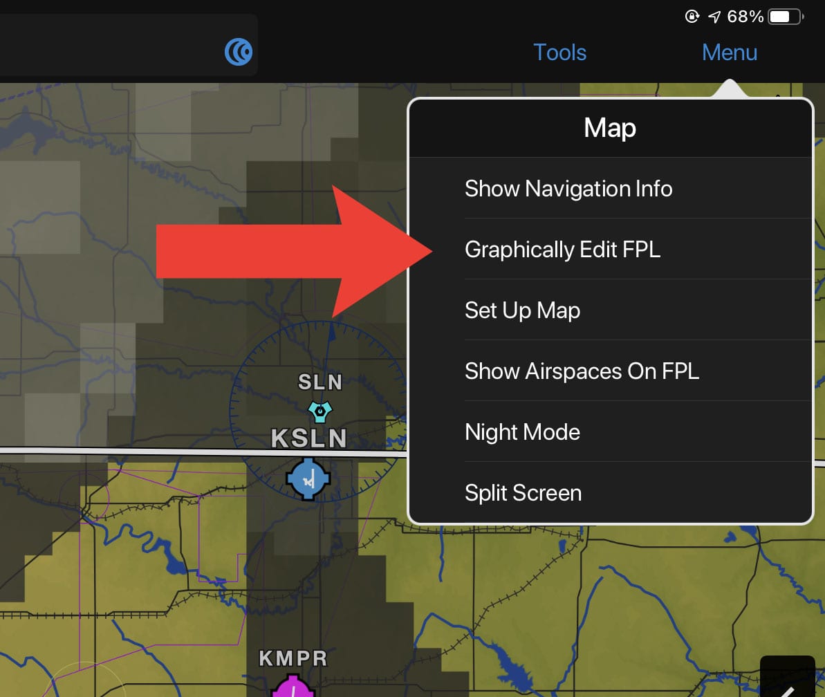
From the Map page, tap the Menu button at the top right, then tap Graphically Edit Flight Plan.
Then make sure you’re in Freehand mode (as opposed to Tap Waypoints mode).

From there, it’s simply a matter of dragging your current route around the weather.

When you release, the app will identify waypoints underneath your Freehand route and automatically add them to your current route. If you’re VFR you can start navigating; if you’re IFR it’s time to tell ATC your plan.
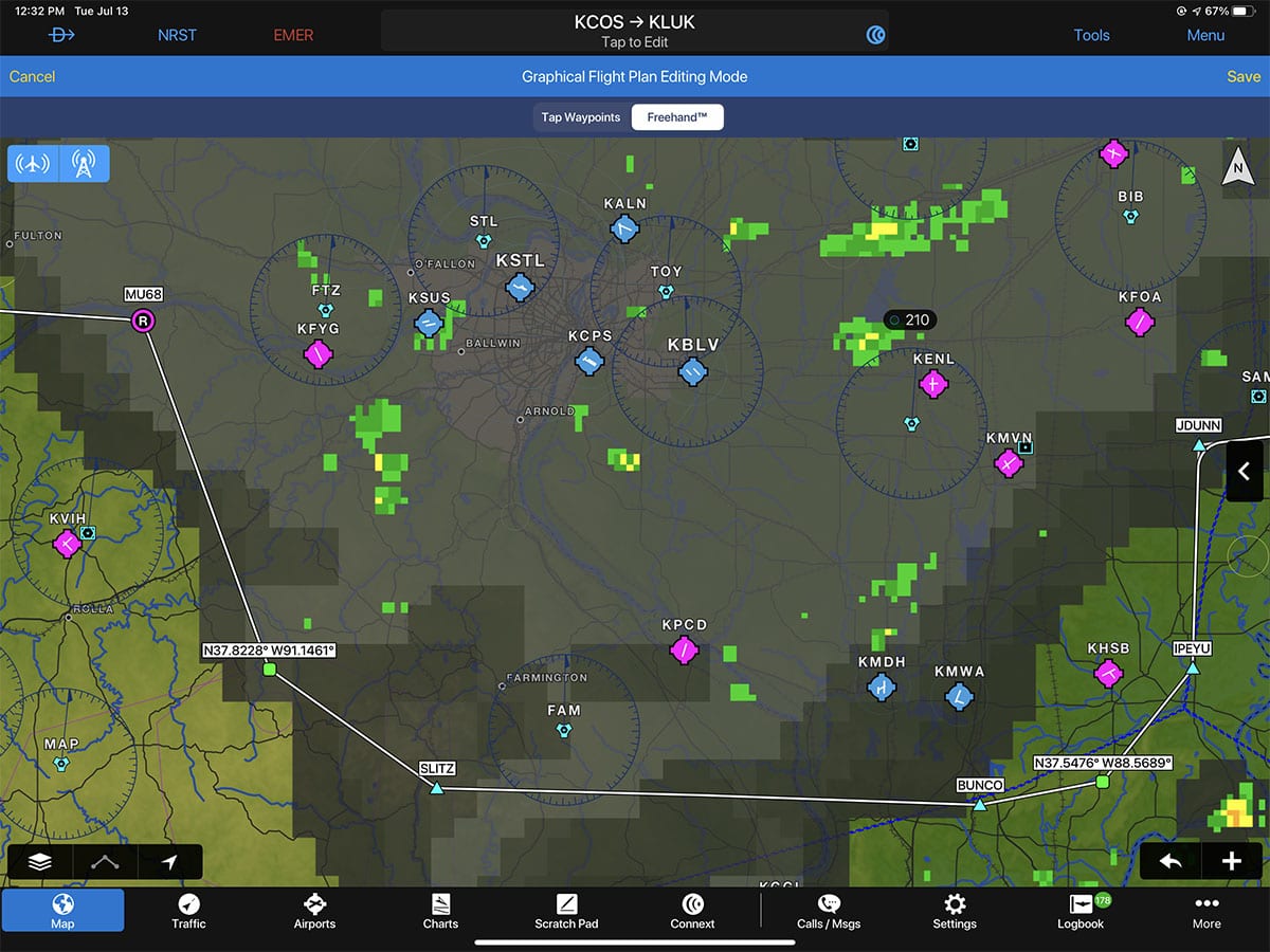
Obviously, you don’t have to follow this exact route, but it’s a great way to estimate how much this deviation will change your time en route and your fuel burn.
Here’s a screen recording showing each step in real time. As you can see, it’s quick and easy.
- Garmin introduces D2 Mach 2 Pro smartwatch with LTE, Iridium - April 24, 2026
- SkyDemon offers simple, VFR-only app experience—is it enough for US pilots? - March 24, 2026
- How to Improve Your iPad’s Battery Life - February 19, 2026

