ForeFlight 101: getting started with aviation’s top app
ForeFlight Mobile has become the most popular iPad application for pilots, and it’s easy to see why. With a nice balance of powerful features, an easy-to-use interface and strong customer support, it’s an ideal app for both professional pilots and weekend warriors alike.
For a new or prospective ForeFlight user, how do you get started? While we have dozens of ForeFlight tips on this website, in this article we’ll try to cover the basic information that a new ForeFlight user needs to get started. We’ll also link to many of the other tips about ForeFlight on iPad Pilot News.

One ForeFlight subscription will run on two devices: an iPad and iPhone, or iPad and iPad mini or two iPads.
How to get the app
Installing ForeFlight is fast and easy. Tap on the App Store icon on your iPad’s home screen, then search for “ForeFlight” in the search box at the top right (or click here). You’ll see the app appear as the first search result, and from there you can tap FREE and then INSTALL to confirm. This will start the download and add a ForeFlight icon to your iPad’s home screen. Once the download is complete, just tap the icon to open the app.
The app is actually free to install and use in demo mode, so go ahead and start flying with the app to get used to it. You will, however, need a subscription to unlock all the features and get access to regular chart updates. This subscription can be purchased in the app, from ForeFlight or from Sporty’s.
Once you’ve purchased a subscription, you will use that email address and password to sign into ForeFlight and unlock it. Tap the More tab, then Accounts, then ForeFlight under “Account Logins.”
Main app features
Now let’s explore the app’s main features. Along the bottom of the screen you’ll find eight buttons or tabs. These tabs are always visible, and show the core sections of the app. Spend some time getting to know each of these features:
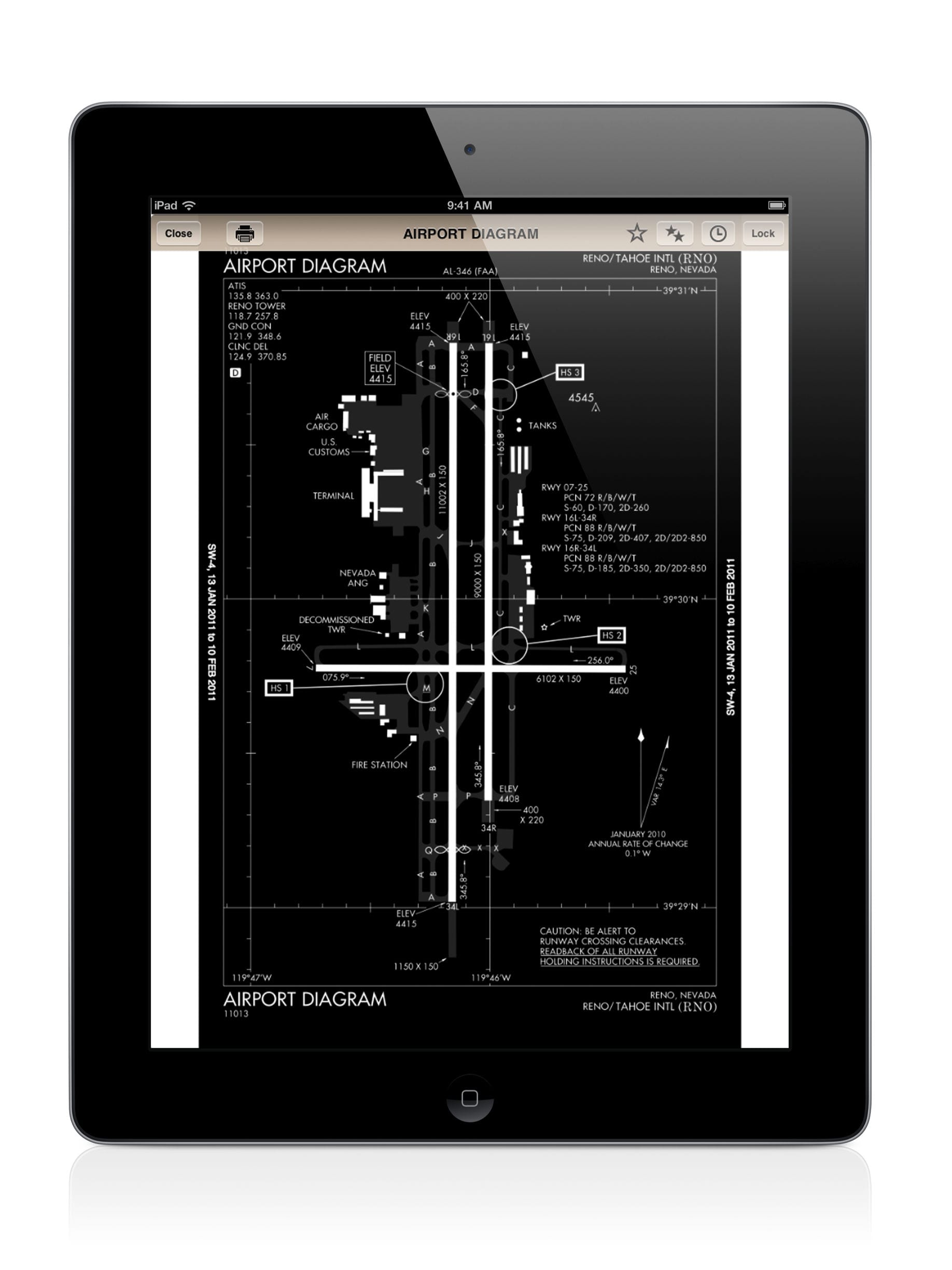
Airports – A wealth of information about any airport: find the tower frequency, check NOTAMs for your destination airport or read the latest METAR for your alternate. This is very helpful when planning a fuel stop or choosing which airport to use on a trip. You can also view taxiway diagrams (tap the icon at the top right), instrument approach plates and even the complete Airport/Facility Directory information. Just search by airport name or identifier at the top right to bring up an airport.
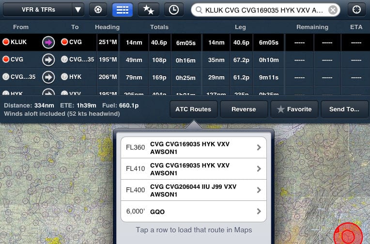
Maps – This is the tab you’ll spend most of your time on while flying, as it offers moving map sectional and IFR en route charts, plus GPS data and flight plan information. Tap the menu at the top left for a drop-down list of all the different charts and weather overlays you can view. Then enter your flight information in the search box at the top right, just as you would in a flight plan. For example, KCVG HYK KATL 170KTS 9000FT gets translated as: Cincinnati airport as your departure, via the Lexington VOR to the Atlanta airport at 170 knots and 9000 ft. ForeFlight will display this route on the chart. Tap the flight plan symbol at the top center (third from the left) to show your flight plan legs, and tap the instrument symbol at the bottom to bring up four GPS data blocks that can show a variety of information, from groundspeed to GPS accuracy. Read more tips on using ForeFlight’s “Advisors” in this article.
Plates – A quick-access place to view approach charts, arrivals, departures and airport diagrams. Having this separate makes it easy to switch between en route maps and approach charts as you get close to your destination. Search for airports by identifier or name, then choose which chart to view. Pro subscribers will even see their airplane position on the chart.
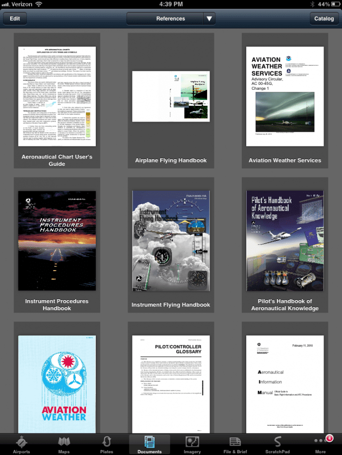
Documents – Organize your digital documents, like aircraft manuals and FAA publications. ForeFlight includes a catalog of available documents that can be downloaded for free, or you can import your own PDFs, JPGs, GIFs or PNGs. Read more tips on using Documents in this article.
Imagery – The place for pre-flight weather briefing graphics like radar, satellite, prog charts and more. Most images are from the Aviation Weather Center at the National Weather Service.
File and Brief – When you enter your DUAT/DUATS account information, you can get an official FAA pre-flight briefing and even file your flight plan from this page.
Scratchpad – Copy your clearance or ATIS information with this digital scratchpad. A stylus makes it easier to write quickly on this tab, or choose the type option.
More – A list of secondary features, like account settings, database downloads and accessories. This is also the place to customize all of the Map features that are available.
Updating your charts
While it doesn’t sound very exciting, perhaps the single largest improvement of the iPad over paper charts is the update process, and ForeFlight does it better than anyone. Gone are the days of tedious Jeppesen paper chart binder updates—with an iPad, you simply tap a button and walk away.
The first time you use ForeFlight, you’ll want to choose which charts you want to keep updated. First tap the More tab, then Downloads. Next, tap United States and choose which types of charts you use: taxi diagrams and A/FD, terminal procedures (approach charts), VFR charts (sectionals and TACs), IFR low en route and IFR hi en route. Below this, choose which states you need coverage for by tapping on the state name. You’ll see a check mark when you’ve selected each state.
Now tap Downloads at the top of the page to go back to the main Downloads status page. A green Download button will appear, which you can tap to download all the charts you just selected. This can take up to an hour, so make sure you budget plenty of time (and battery power) for this update process.
ForeFlight will alert you to update your charts every 28 days with a red circle on the ForeFlight icon. The number inside the circle indicates how many chart databases need to be updated. Open ForeFlight and tap the More tab, then the Downloads menu. This brings up your chart database status page. After the first time setup, you can simply tap the Download button to update your charts to the latest version—it’s easy.
Note that ForeFlight will allow you to update your charts before they become effective. It stores the new charts, and automatically makes them active when the time comes–there’s nothing to do after you download an update.
Accessories
To take ForeFlight to the next level, consider adding an external GPS or ADS-B receiver.
An external GPS is a must-have, in our opinion. For around $100, one of these GPSs makes ForeFlight a fantastic in-flight navigator in addition to its many pre-flight uses. Simply connect via Bluetooth and go to the Maps tab. You’ll see your airplane flying along the chart, and the four data blocks in the HUD will provide useful information. For more information about iPad GPSs, read tip #8 in our Top 12 iPad Tips.
For the ultimate in-flight experience, an ADS-B receiver is a great option. ForeFlight supports Stratus, a completely wireless GPS and ADS-B receiver that allows you to view nearly real-time weather in ForeFlight. Connect Stratus (via WiFi) and go to the Maps tab. From there, the Stratus GPS will automatically provide position information. To view weather, tap the map overlay menu at the top left of the screen and choose radar, METAR, TFRs or any of the other ADS-B datalink products. You’ll find navigating around weather with Stratus and ForeFlight to be about as easy as it can get. For more information on Stratus, see this pilot report and this article.
Tips and tricks
Once you get familiar with ForeFlight, there are some basic tips that will speed up common tasks and add new features:
- Try rubber band flight planning. If you get a re-route in flight, there’s a fast way to graphically edit your route in ForeFlight. Simply tap and hold your course line. When it turns blue, you can drag your route to a new waypoint. This is also very helpful for navigating around weather.
- Yes, you can do Direct-To. From the Maps page, just enter D and the airport identifier to go direct to your destination. Or, tap on the airport symbol and then the D–> button.
- Create custom approach plate binders. By creating different binders in the Plates tab, you can store favorite approach charts or every chart for a particular trip. It’s an easy way to stay organized. Simply tap the menu button at the top of the page, then tap + to add a new binder. Read more tips on using Plates binders in this article.
- Add favorite airports. Are you constantly checking the weather at the same few airports? Make them favorites and save time searching. From the Airports tab, search for an airport, then tap the star button at the top. This automatically adds the airport to your favorites list, accessible from a drop-down menu (or left side menu in landscape mode).
- Use map layers for more than weather. In addition to the usual map overlays like radar or satellite, you can also get a visual depiction of some other useful data. TFRs are easy to avoid using this feature, and should be part of any pre-flight check. Fuel prices can also be overlaid on the map, which is handy for planning fuel stops that aren’t too far off course.
- Add your airplane’s data. When planning a flight, you can make the time en route and fuel burn calculations much more accurate by using your aircraft’s profile. To set this up, tap the More tab, then Aircraft and add a new tail number. This information is also used for flight plan filing.
- Use Runway Proximity Advisors. This new feature is turned on by default, and it’s a major safety enhancement. If you have a GPS source, ForeFlight will alert you to all runway crossings with a pop-up banner and an audio alert (if your iPad is connected to your headset). Learn more about this feature in this article.
More information
Yes, real pilots don’t read manuals. But ForeFlight’s free Pilot’s Guide is refreshingly easy to read, and it comes built-in to the app. Just tap the Documents tab, then the ForeFlight menu. You’ll discover dozens of features you probably don’t know about. Or, read the manual online.
For more information on getting started with ForeFlight, watch our seminar on Flying with the iPad.
For advanced tips, our webinar on Advanced iPad Flying has a large section on ForeFlight.
Conclusion
As this basic introduction shows, ForeFlight can be a major enhancement to your flying and even save you money. There’s a lot of information in this app, but the best advice is to download the free version and start learning. There’s no substitute for tapping around the app and learning to use it your way.
You’ll never have out of date charts again!


Foreflight is best and most of our local flight depts have tried all avail.
Is it possible to load your Foreflight in a Windows
computer for learning, before using Foreflight in an iPad to fly?
ForeFlight offers a 30 day free trial and before I flew with it, I learned all about it on the ground. Then I tried it in the car (with my wife driving) when we drove on a short trip. It’s very easy to use. I’m pretty sure they do not have a Windows version. Also, I have not tried this yet, but someone just came out with a way to use both X Plane and MSFS with Fore Flight.
Foreflight would be perfect if IF it allowed Jeppesen plates instead of govt. plates.
I have somehow continued to receive “Pacific AF/D
Supplemental” in spite of my efforts to remove it from my Foreflight. I stroke delete and for a few seconds it appears I am successful but the download for the Pacific– starts and I cannot remove it. What am I doin’ wrong?
Bob, I assume this is in the Documents tab? If so, tap the Edit button at the top left of the screen, then tap the X on the document you want to delete.
Are they planning to include South America as well?
Do you have any maps for South America, and the Carrieabean. Larry
ForeFlight has limited Caribbean charts, but Jeppesen is the only app with real international charts.
Just got it and its amazing
Is it possible to print approach plates in normal half page size? I’ve tried this from the Ipad to an AirPrint printer however it prints full page (8.5×11) which is too large.
I’m an avid flight sim guy who loves to fly . Can the information for plotting your route be exported to the flight management computer in flight sim.
I used foreflight on an ipad mini in IMC, at night, light rain and flew a GPS approach into my home field after two hours of night flying. I had the brightness turned full dim. Nice option but it was still too bright and was distracting when transitioning outside the cockpit for landing. Can the next version bring the brightness down alittle more? When compared to the Aspen Evolution, the ipad mini was still brighter.
I have downloaded the March something to April 3 database. Many of the airports I go to are omitted. I cannot find “Y47” nor “KLDM” nor “KFCM”. There are lots of missing airports. What is going on?
My cell phone 248 802 1284